Here comes my Northern California road trip. It was no well planned, but we had fun! I won’t recommend people to follow our exact footprint – you can do much better than us! But saying which, even with minimum planning, we gained a quite wonderful vacation. This region of the Pacific West is just great.
Day 1 Medford, Crater Lake, Heartline Ranch
Although we started planning for this trip more than a month ahead, we only managed to figure out the rough dates and routes. The following month was quite busy for both of us, and I attended a conference in New Mexico in the week just before we set off. With all said, we weren’t very prepared when we left home. I just came back from New Mexico the night before! I was tired and mildly annoyed by my own arrangement of the schedule when we boarded the early morning flight. So we decided to keep our expectation low for this trip and try our best to relax.
However, a text notification of a power outage back home greeted us the moment we landed in Medford. Our two cats relied on auto-feeder and fountains to survive, so some quick arrangements had to be made. While Ziwei was booking a last minute additional pet sitter visit, I texted my friends for help. The first half an hour of our vacation was quite chaotic with both of us full time on our cells.
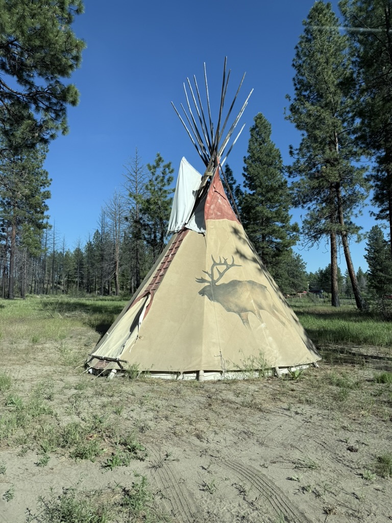
After finally sorting that out, we got our rental car and were eager to hit the road toward the crater lake. Ziwei asked me to set navigation to our stay for the first two nights. I looked through my emails and booking account but couldn’t find the confirmation. Only at that moment I realized, I only had thought about where to stay for the first two nights, but didn’t actually make the reservation. Fortunately, we were both in good mood so there wasn’t any finger pointing. I quickly booked a tipi in the heartline ranch for two nights, and we started our drive to the crater lake.
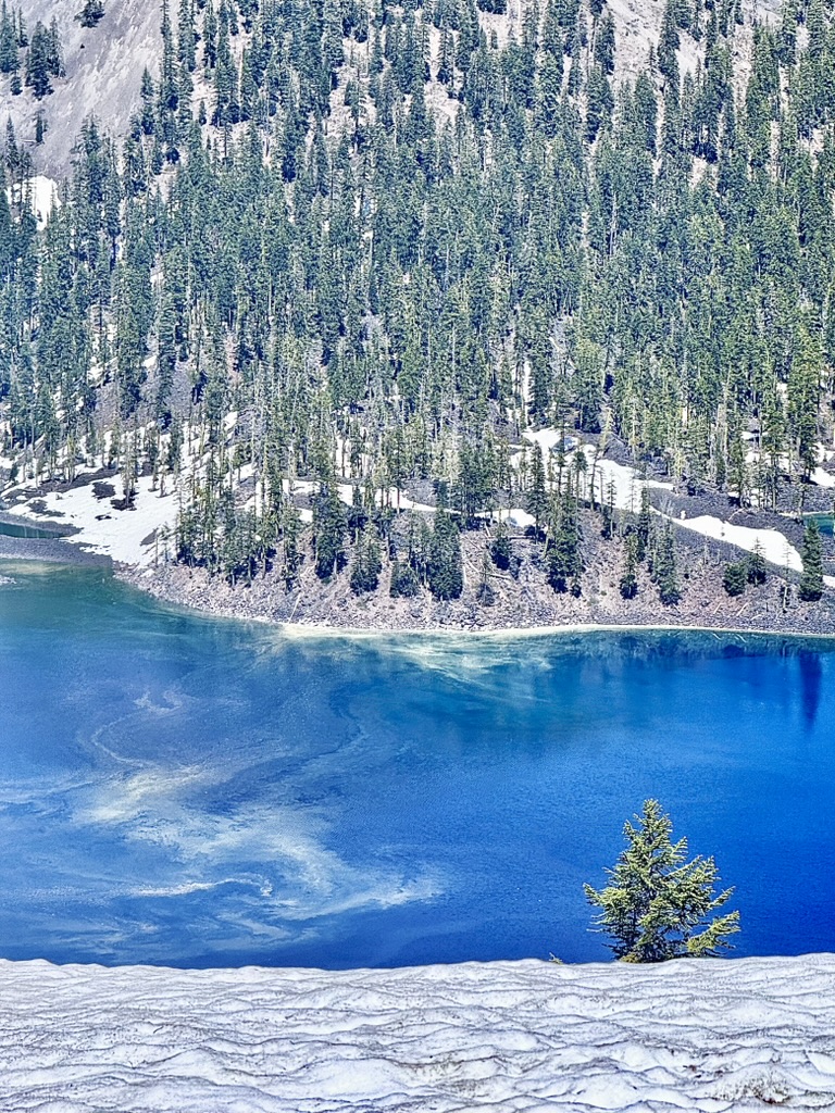
The weather was fabulous. The crystal blue color lake was absolutely beautiful. There was still quite some snow around the lake, but it was so warm under the sun that t-shirt and shorts would do. We wanted to do the Cleetwood Cove Trail to touch the water, but road was still closed from both sides. So we just parked our car and walked around for a bit.


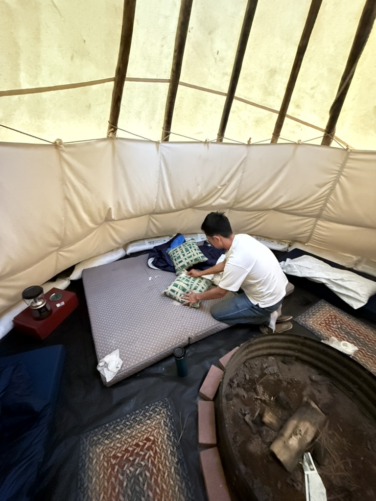
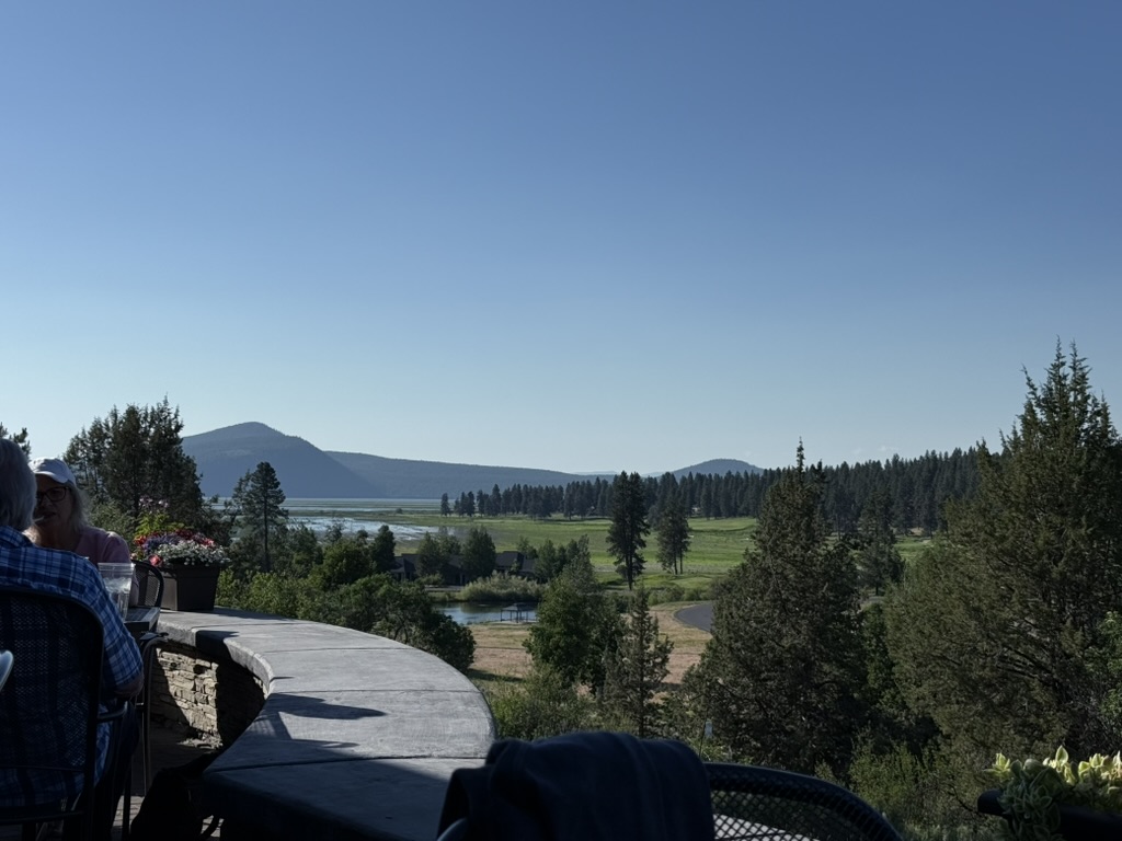
We were tired and eager to rest in our temporary nest, and the check-in time at the heartline ranch was before 6 pm. The host welcome us upon our arrival and led us to our tipi. I was prepared for a natural accommodation, but the level of dustiness inside the tent still surprised me. I guess it was still quite early in the season so we must be among the first batch of tourists. I ran into spider strings almost everywhere inside the tent, and the mattresses was with a couple days (at least) worth of dust. Ziwei was a lot more picky about the comfort of staying (for the record, he is definitely not a camping person), so he dragged me to a closed by dollar general and got some wipes and bargain clean sheets. We got dinner at a burger shack in Chiloquin.
There final surprise of the night was how loud are cows. I mean, they seem to be quiet creatures but are very, very noisy. Especially at before sunset and around sunrise time, they yell like crazy.
Day 2 Klamath Falls, Crater Lake Zipline, RY resort
Waking up early in the morning to the call of cows, I checked my watch and found out it was just before sunrise. Ziwei was still snoring. Consider how upset was he about bugs and dust the previous night, I decided to leave him sleeping and crawled up for the sunrise watching myself. I wandered to the way side of hwy 62. I could see the cows now after hearing them for the whole night.
I shook Ziwei up after the sun was out, then took a quick shower in the portable shower with on-demand hot water. Ziwei was determined that we were not coming back for a second night, so we packed up and waved goodbye to the tipi.
We drove along the Klamath Lake with mount McLoughlin on our right. The view was beautiful in the gentle early morning sunshine. When we arrived in Klamath Fall, all the stores and cafes weren’t open yet. We waited until 8 and got coffee from A Leap of Taste. Without any plan until 2 pm, we walked along the main street, crossed the link river to the Favell museum (which was also closed), then walked back. We spotted some ducks on the link river from the bridge. Little did we know that we would encounter this same river again days later, at where it enters the pacific ocean.
As there was so much time to kill, we went back to the Leap of Taste cafe and ordered a second round of drinks. We took a outside seating and read under the tree shades. I was reading the Into Thin Air by Jon Krakauer, which was absolute fascinating.
Finally, past noon, we set off for our next activity, which is the Crater Lake Zipline located at the north tip of the Upper Klamath Lake, but on its west side. I booked it on our way from Medford to Crater Lake on the previous day. The Zipline was very fun! It was our very first zipline experience so there was nothing we could compare it to. But fun is fun. That much we could tell.


Ziwei picked the RY resort for our second night. It was everything in the opposite of the heartline ranch, and not much more expensive. But to be fair, the tipi could fit way more than two persons. So if you have a larger group, the heartline ranch would still be significantly cheaper.
Day 3 Lava Beds, Medicine Lake, Shasta
We rested well in the RY resort. As we were packing up in the morning, I browsed the map and spotted the Lava Beds National Monument. We added it to our itinerary.
Shortly after we turned onto the Volcanic Legacy Scenic Byway, the landscape became very alien and magical. It’s like under the similarly vast sky of the Mojave Desert, but with many small cone shaped little hills scattered around. It’s like in video games. Photos can hardly do the justice.
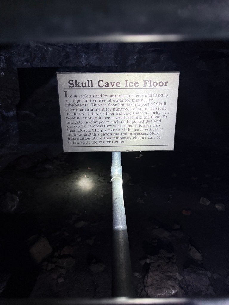
The National Monument was famous for its hundreds of caves formed from lava tubes. Permits, lamps, can be granted from the visitor center. Visitors unprepared like us shouldn’t try the advanced level caves. We checked out the Mushpot, Sunshine, Upper/Lower Sentinel, and the Skull. The caves were very cool, both the experience and temperature wise. The formation of the caves were cool stuff to learn about too. I won’t rewrite those here because I am very bad at technical writing. See the Wikipedia!

After talking to a park ranger, we decided to drive out the park through its southern entrance. We were promised with limited snow on the road all the way up to the medicine lake. The medicine lake is at the highest point of this massive shield volcano. I learnt about the difference between composite versus shield volcano on this trip. The shield volcanos are much wider. Our way up to the medicine lake had such a gentle slope that we could barely tell that we were ascending. The road was sandwiched by thick forest on both side, so there was little to see. It was also very deserted that we encountered almost zero traffic along the way. After a fairly long lonely drive, occasionally avoiding snow on the road, we got to the top.


We arrived in Shasta in the early evening. I didn’t realize Shasta is such a spiritual place, which was a surprising finding.
Day 4 Shasta, Shasta, Shasta
When we planned this trip more than a month ago, I was struggling about if we should try a summit of the massive mount Shasta, or not. We decided not to at the end. The top would be likely still covered by snow in mid June, which means we would have to prepare with special tools and slightly more complicated logistics than a normal hike. I wasn’t positive about my active level before the trip either — it was a busy month and we knew it from the beginning.
When we arrived at Shasta City, it was clear to us that giving up the thought of submitting was very wise. The top was heavily covered by snow, and we were tired even before the trip started. So the plan was just to chill and do some light hiking. (I was thinking of checking out the Burney falls, which is a two-hour drive round trip. We decided not to go to save energy for the upcoming long drives in the following days.)
We got coffee and breakfast from the Theory Coffee Roaster in town. Then we read off the morning. It was sunny and slightly hot outside, and the forecast promised some clouds in the afternoon. We set off for the bunny flat parking lot around 12pm.
There are a couple trail heads around the area. The driving road beyond this point was still closed. I was saying to first go to the horse camp, then decide from there on how far further to hike. To my surprise, even the 1+ mile trail leading to the camp was very more snowy than I expected. Consider we were just casual walkers without any assistant tools — Ziwei even forgot his sunglasses — we went no further than the horse camp.


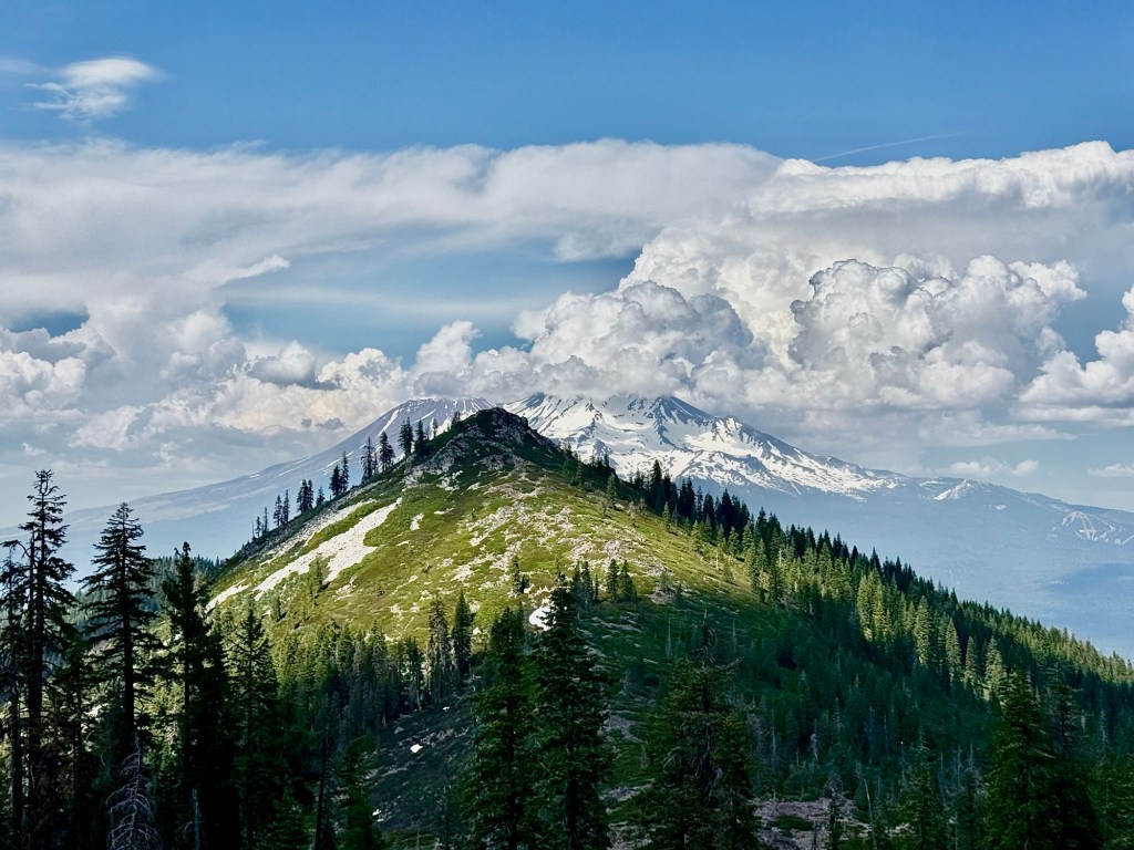
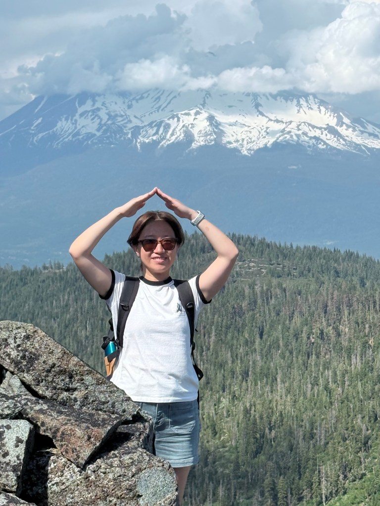
We drove down the mountain, crossed freeway 5, and headed to the castle lake for a second hike. The castle lake to heart lake trail was a quite popular one for its beautiful view of the Mount Shasta. There were a few families enjoying water activities on the lake when we arrived, but the trail itself wasn’t very crowded. The hike was absolutely beautiful.

Day 5 Shasta to Eureka, mostly driving, occasionally walking, and line dancing.
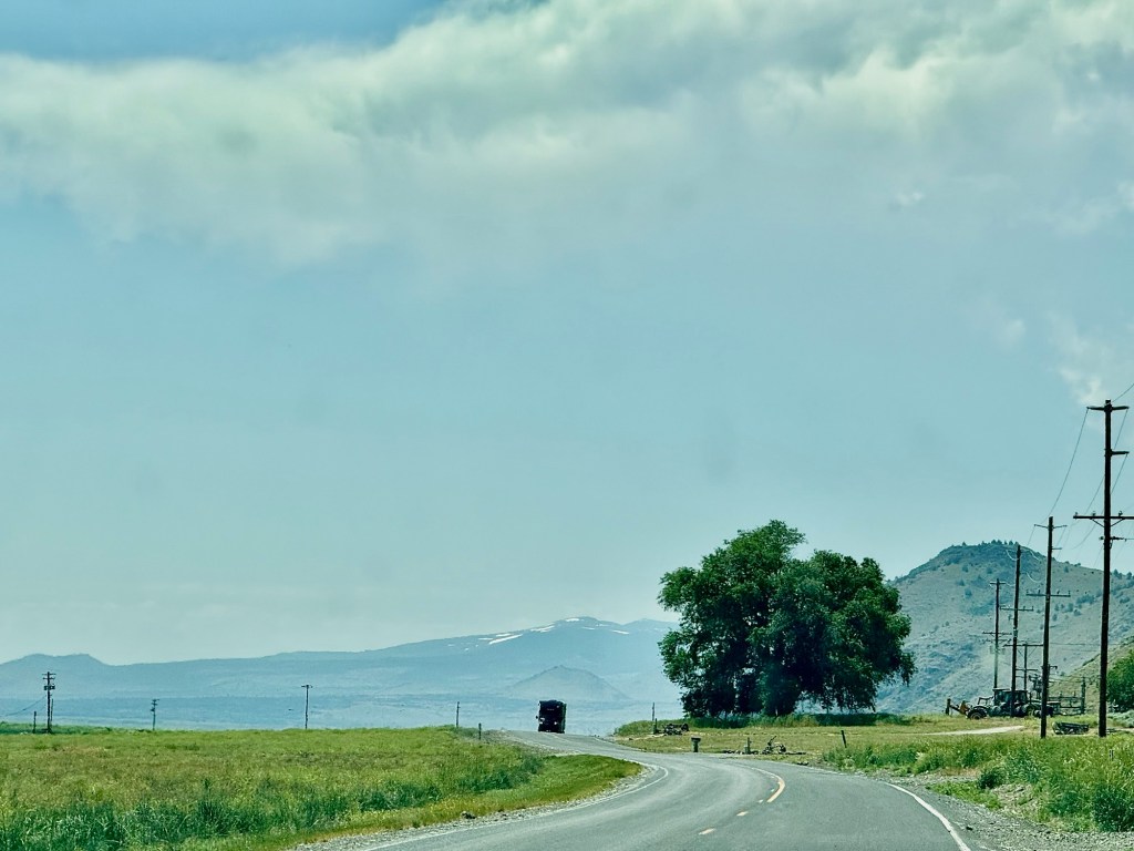
We took hwy 5 to 299 to cut through mountains. It was a long scenic drive.
We made a few stops along the way. The quick detour at the Shasta lake & cavern was unsuccessful. The cavern boat tour needs at 3~4 hours planned time. So we just used the restroom and took a quick peek at a corner of the big lake. We also stopped at the Sundial Bridge in Reddening and took a chill walk.
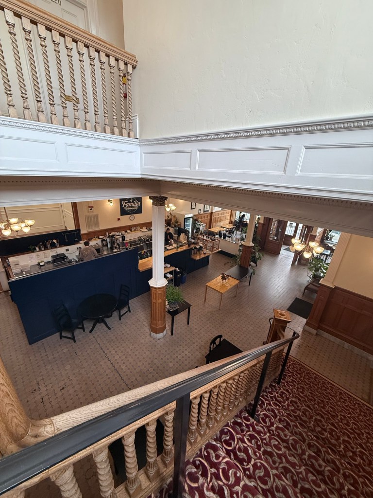
We got to Eureka at around 4 pm. The hotel here was chosen by Z. It’s the Eagle House at C and 2nd street. It’s a Vintage hotel in a historical building. We went to the Irish bar downstairs for a quick dinner, then walked around the old town area. The looks nice, exterior wise, but to my surprise, it’s so empty. It was just 5:30 and there was almost nobody on the street. The atmosphere was slightly weird, and the wind was chilling. We headed back to the hotel shortly.
The hotel has a big ballroom and there is line dancing lesson very Wednesday night. It’s a regular event targeting more at local residents than tourists. I joined for like an hour. That was fun!

Day 6 Eureka, redwood
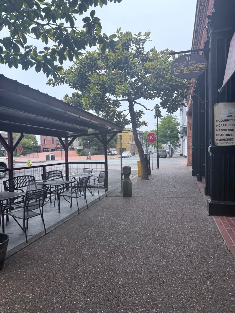
As usual, we had a slow start in the morning. The weather was as gloomy as last afternoon, and the streets were as empty. Around 9:30, we got to the Familia Eureka cafe. It’s in another historical building. This town is full of old buildings, together with the emptiness, I developed a weird unease feeling towards this place.
As I was wondering, so I searched, and found a webpage saying that Eureka has the highest homeless rate per capita in the state. While I don’t know how updated that piece of information was, it does match my impression. Especially during the relatively quiet hours in the morning and later afternoon, the delicate stores (mostly closed) and wandering hobos form a high contrast picture.
We drove up to the Redwood National and State Park soon after coffee. Sky was gray. We made a quick stop at the visitor center at the south tip of the park the headed toward the Lady Bird Johnson Grove. It’s a very popular area so we did not feel remote or isolated—there were kids running around and elders wandering. But the place was magical nonetheless. It was still foggy when we went in, and the tall coastal redwoods’ top almost disappeared into the thick fog.

We drove to the Prairie Creek Visitor Center and joined a quick ranger guided tour. We didn’t stay long because of hunger. We didn’t bring food with us and failed to find any in park stores. So we headed out around 3 in the afternoon.
We randomly stopped at Trinidad for pizza. The place we went is called Headies Pizza and Pour. We said to grab two slices to temporarily comfort our stomach and save room for dinner later. But the pizza was so good that we ended up ordering two more and adding a Pilsner! We sat at the window seat with a couple redwood standing right outside. The meal was quite satisfying.

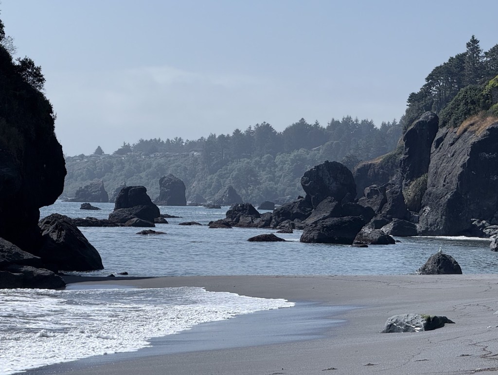
We were a lot more energetic after eating and decided to check out a beach close by. There was a scenic drive right next to 101, which leads to the Luffenholtz beach. It was a beautiful place. To get to the ocean, we had to cross a small river formed by trapped water at low tide. We tried jumping over it but fell in. Shoes were wet.
We got back to Eureka late afternoon, checked out the guitar shop across the street from our hotel, then chilled out for the rest of the night. There was live music in the cocktail bar downstairs.
Day 7 Redwood, Klamath, Rogue River
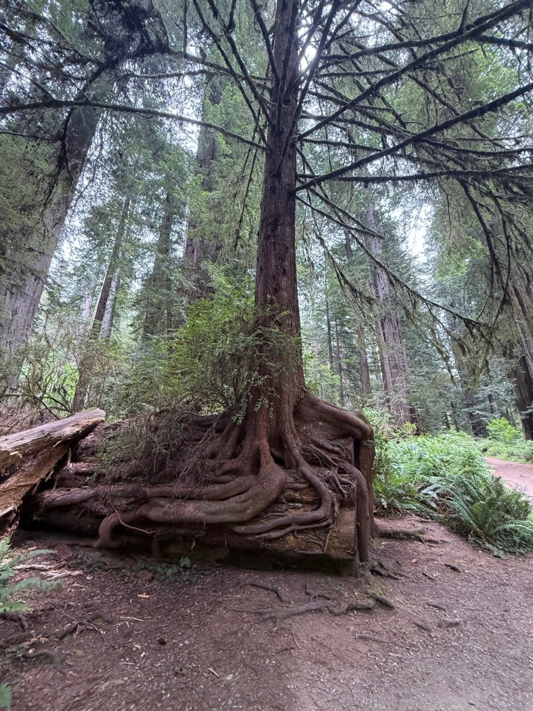
We left Eureka today heading back to Oregon for our last night of the trip. As we passed through the park, we stopped in the Prairie visitor again to walk a 3 mile trail (Karl Knapp-Cathedral Tree) in the fascinating redwood forest. I picked a salmon berry along the trail and tasted it fresh. In the park, it’s okay to collect berries for your own consumption. We also noticed bunch of magical scenes today. Like a newer redwood grows out inside an empty shell of an old trunk, or a smaller tree grows on a fallen trunk, as in the photo below.
Hunger attacked us again after the little hike, so we stopped in the small town Klamath for a quick bite. The diner in the casino was closed so we ended up in a dive bar with half of its ceiling covered with dollar bills. The corn dogs and burger were good! The ladies’ bathroom was decorated with some muscular photos, so I became curious and sent Ziwei to check out the men’s bathroom. To my disappointment, there were only a couple posters in drinks and guns theme.

Klamath might have become a familiar name now. Earlier in the trip, we stopped by Klamath Fall and walked by the Upper Klamath Lake, which is the origin of the Klamath river. Now we arrived at the point where the river meets the ocean. Not very far from the Klamath town, there is a river overlook with fabulous views and a couple picnic tables. We should have taken the food here for a picnic in this nice weather. We make a quick stop then drove away.

Our last overnight stop was in Rogue River. It’s a peaceful little town with around 2000 population. We grabbed dinner at the Rogue River Station restaurant, each had a glass of Oregon Cabernet, then went to the Tailholt Coffee Co. for decaf beverages. The cafe opens until 10pm. We went in at around 8:30 and were the only customers group. The lady behind the coffee bar chatted with us for a bit. Ziwei was attracted by the guitar on the wall. With permission from the lady, he took it off and played a song or two. And that concluded our last night in Oregon.
Day 8 The End
On our way back to the Medford Airport, we stopped by the river bank of the Rogue River in the Vly of the Rogue State Park. On the short way toward the river access/fishing point, under the warm Oregon sun, I was reminded of some vague but comforting childhood memories. The quiet afternoon in Dabeiyao left a deeper mark on me than I thought. And this strange, remote connection made me fall in love with the peaceful Rogue Valley area.
The very last stop was the Story Telling Stone at Ti’lomikh Falls. The Rogue River in front of us origins from Crater Lake, linked us back to the starting point of this wonderful journey. The stones around the spot were carefully arranged with their surface smoothed by force of history. They, together with the many information boards we encountered along the road, and the many names of places, mountains, rivers, landmarks, reminded us of the long peaceful years before the western settlements. The forced transition upon all the native tribes, Takelma, Klamath, Shasta tells a complex story of human histories, which I couldn’t claim to remotely understand. I will stop right here and leave my promise of continuous learning on the relevant subjects.


Final remarks
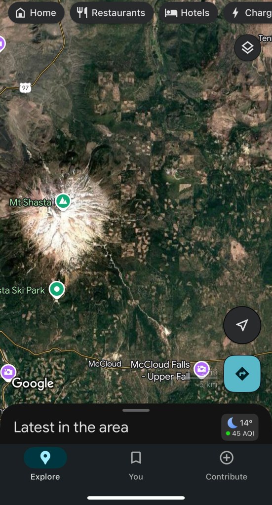
I fell in love with the cascade volcanos and the wilder pacific west. I will come back again, as long as life permits, to dive deeper into its forests and peaks. Among all the wonderful things I saw on this trip, the one strikes me the most is the satellite image of the area. The checkerboard pattern, which I thought was patching error of the map app at first, turns out to be real. It’s the combined result of land ownership arrangements and timbering. See the wiki page.
I always feel that it’s hard to find words on such subjects. Honestly, there is no strong feeling inside me, but just a mix of mild shock, fear, and confusion. For another time, I will leave it here, but remember that this planet has so much more for me to love, experience, and be alarmed about.

Leave a comment